
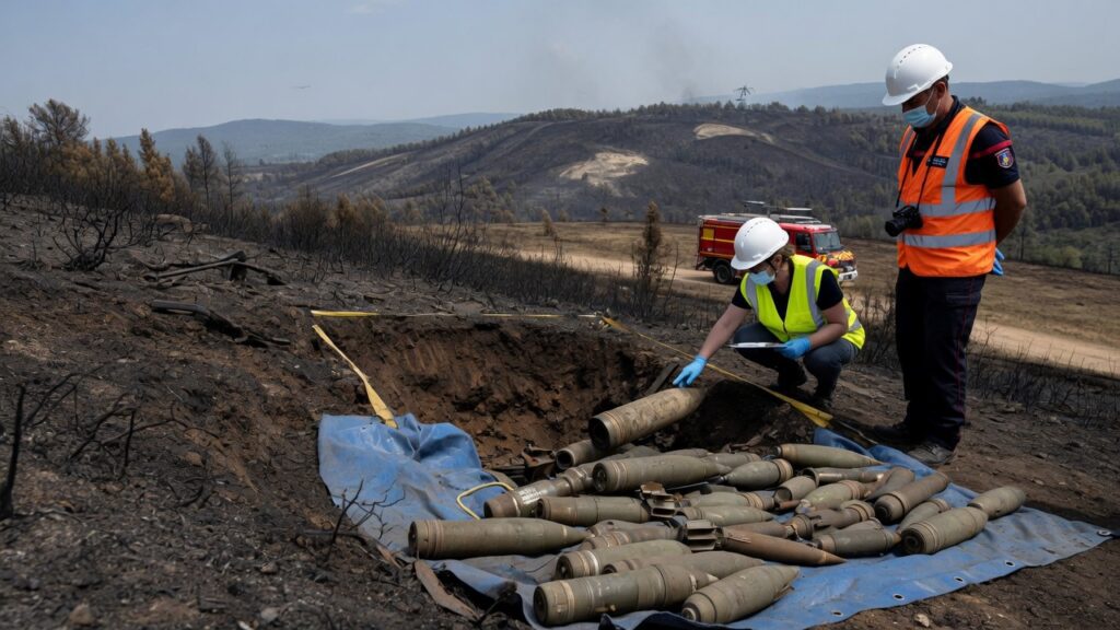
The recent discovery of over 400 WWII-era shells during wildfire suppression efforts in France underscores a critical challenge for contemporary disaster response systems: the integration of incomplete historical records into digital infrastructure models. As advanced technologies such as satellite imagery, AI-driven predictive analytics, and real-time GIS mapping are deployed to combat climate-amplified fires, buried remnants from past conflicts emerge as unexpected variables that can disrupt operations and endanger personnel.
Bridging Modern Disaster Response to Historical Oversights
Wildfire management increasingly relies on layered data platforms that combine meteorological forecasts, terrain modeling, and resource allocation algorithms. When suppression teams in France encountered unexploded ordnance, it highlighted how 80-year-old bureaucratic records—often stored in fragmented analog archives or early digital formats—remain disconnected from these platforms. This creates operational blind spots where fire response strategies must be abruptly altered, delaying containment and increasing costs for specialized ordnance disposal units.
Implications for Data Infrastructure and Risk Modeling
Effective infrastructure resilience now demands comprehensive historical hazard datasets merged into cloud-based emergency systems. Without automated data ingestion pipelines capable of cross-referencing wartime inventories with current land-use databases, predictive models for wildfire spread and evacuation routes risk underestimating secondary threats. Organizations managing critical infrastructure in Europe are therefore evaluating upgrades to geospatial databases that incorporate machine learning to flag potential legacy munitions sites based on historical conflict patterns.
Policy and Technology Strategy Recommendations
- Develop standardized APIs for merging declassified military archives into national emergency response platforms.
- Invest in AI tools that scan archival documents and satellite imagery to generate probabilistic risk maps for ordnance exposure.
- Establish cross-border data-sharing protocols under EU infrastructure directives to address transnational WWII remnants during multinational disaster events.
These measures would transform isolated discoveries into proactive elements of infrastructure planning, reducing the likelihood that future wildfire responses encounter similar historical interruptions.